17-Jan-2026 — Added reverse geocoding for walks missing locations ref: #104
Migration & Data Population
- Reverse geocoding migration: A database migration was applied to any events that were missing locations from lat/lng coordinates using postcodes.io API. Also populates grid references, locations, and corrects invalid end times. Locations are extracted from walk events using several methods, prioritised by accuracy:
- Coordinates (
coordinates) — Direct latitude/longitude values provided in the event data. This is the most precise method as it requires no geocoding lookup.
- Postcode (
postcode) — UK postcode extracted from event text (e.g., "SG4 7TY"). The system uses postcodes.io to convert this to coordinates, grid references, and locality information.
- Grid Reference (
grid-reference) — Ordnance Survey grid reference extracted from event text (e.g., "TL 192 288" or "TL192288"). Supports 6, 8, and 10-figure references. Converted to coordinates via grid reference lookup services.
- Place Name (
place-name) — Named location extracted from event text (e.g., "Hitchin", "Royston Heath"). Uses geocoding services to resolve to coordinates. Less precise than postcodes or grid references as place names can be ambiguous.
- Title Extraction (
title-extraction) — Location inferred from the walk title itself (e.g., "Afternoon walk from Hitchin station"). The extractor parses common patterns like "walk from [location]" or "Meet at [location]" to identify starting points and trims parentheses for cleaner start location storage.
- Start Location (
start-location) — Location data inherited from an existing start_location field on the event, typically populated from Ramblers Walks Manager imports or previous manual entry. Used when migrating or validating existing data.
- Event history logging: Data migrations now write events to walk history showing fields changed, including geocoding failures for diagnostic purposes.
Location & Search Improvements
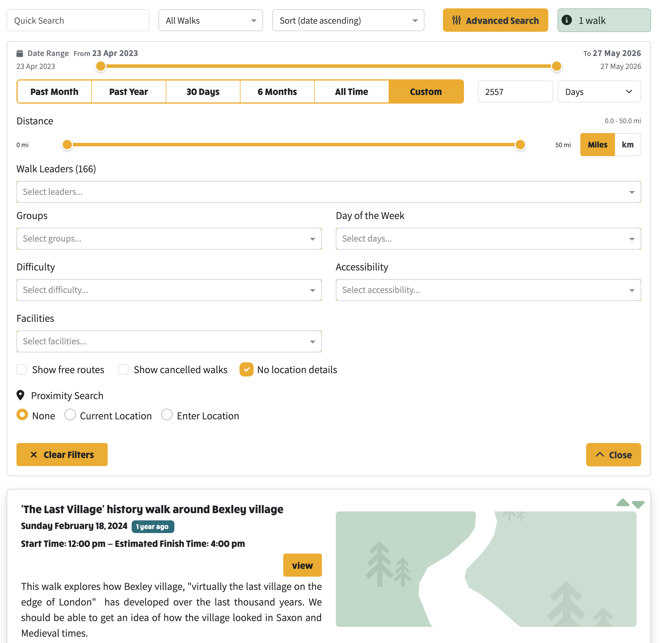
- "No location details": Advanced search toggle now provides additional checkbox to filter events with no location details. Filter only matches walks truly lacking coordinates or postcodes (missing latitude/longitude/postcode/grid reference).
Walk Navigation & History
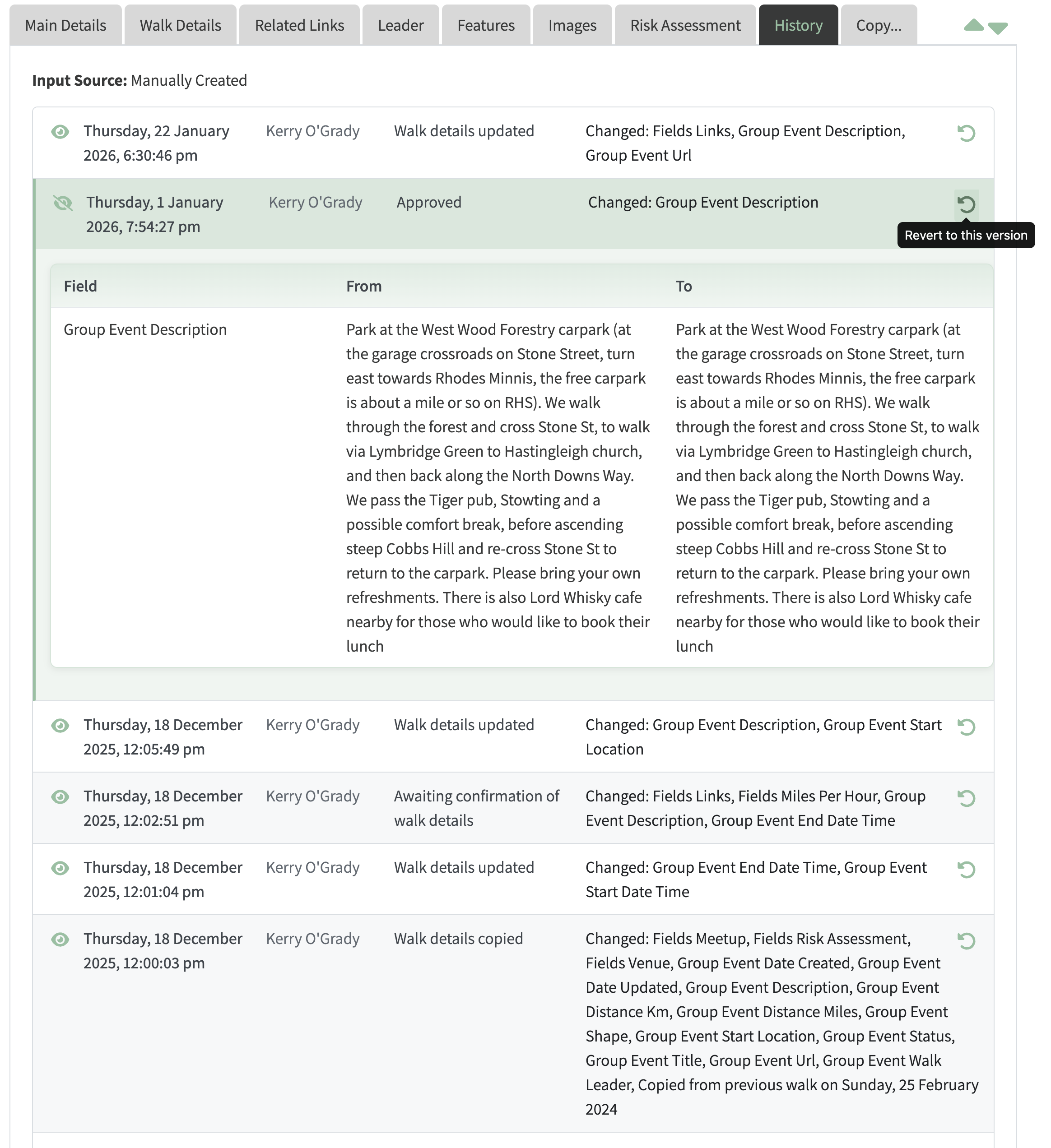
- New "View" button: Walk views now show a view button for members with walk admin privileges, providing read-only access to all NGX-Ramblers fields. Event history view available at
walks/view/<slug>?tab=history.
- Rebuilt history view: Walk edit history expanded for clearer display of field changes . Each row now uses a show/hide accordion which one expanded shows field-level change tables with from/to values.
- Revert capability: Added "revert to this version" for sites with local walk population.
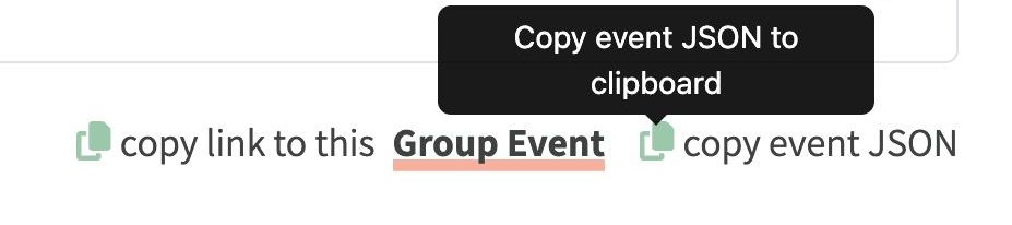
- JSON event copy: Walk edit action row now offers copy JSON to clipboard facility to help diagnose location or migration changes (useful for bug reporting).
Maintenance Admin Changes
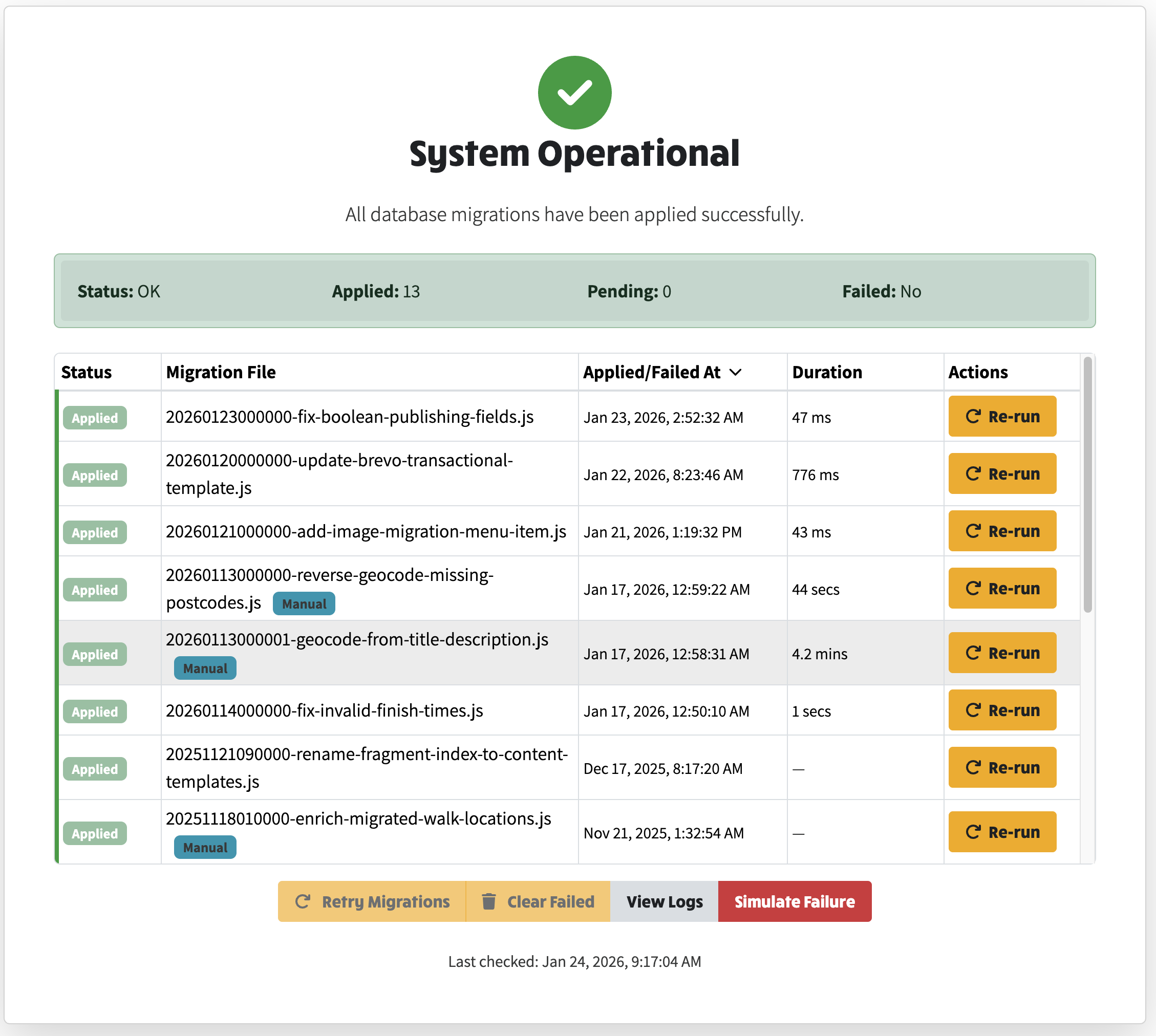
- Applied/Failed and Duration column added to present migration statistics in a cleaner, more readable table.
Refactoring & Code Quality
- Data safety:
WalksAndEventsService consistently reads/deletes from local store to avoid cross-population confusion; edit-group-event-images guards against missing fields.
- Centralised map style selection: Single
OSMapStyle record with zoom calculation flags (is27700, is3857) and key lookup. All map controls/services now consult this record for consistent behaviour across walk-edit, walk list, dynamic-content maps, and admin controls.
- Enum consolidation: Migrated enums/string unions (map providers, backup/session/status/payloads, markdown list types, route profiles, input sizes, AGM stats/tabs, sorting, migration modes, location statuses) into model files. All enums now use kebab-case values and are shared between frontend and server.
- Helper consolidation: Standalone
entries helper moved to functions/object-utils.ts using keys from es-toolkit/compat.
- Mailchimp types: Updated to export const objects + union types matching official SDK shape exactly, enabling
lists.batchListMembers calls without type errors.
- DRY improvements: Shared model files for backup/session configs; server imports rely only on frontend model definitions.
- Consistent location extraction: Data pipeline now uses standardised
GeocodeMatchType (kebab-case values) everywhere.