# 17-Aug-2026 — follow a walk on your phone and edit the route [ref #151](https://github.com/nbarrett/ngx-ramblers/issues/151)
## [build 834](https://github.com/nbarrett/ngx-ramblers/actions/runs/32036227122) — [commit c3f7c75](https://github.com/nbarrett/ngx-ramblers/commit/c3f7c7511782ea48e468a77439848c6395b2ba73)
---
## What's new
You can now follow a published walk on your phone, and if you can edit the walk you can draw, record or tidy the route while you are there. This page is the user guide: it starts on the walk page, then walks through Follow, the Walks app, editing the line, and choosing a map.
## On the walk page
Open a walk from the programme. Under the description and map you will see the group, the related links, the start details, and the buttons that open Follow.
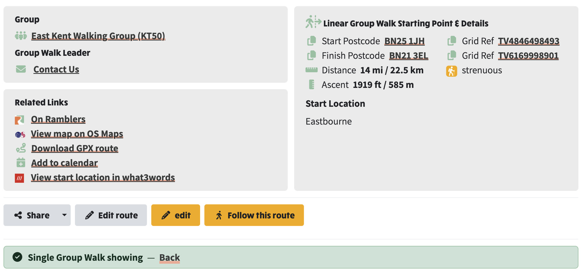
*The walk page: group and related links on the left, start details on the right, then Share, Edit route, edit and Follow this route*
### Related links
- Each link has its own mark, so you can pick the right one at a glance.
- On Ramblers (the orange Ramblers R) opens this walk on ramblers.org.uk
- View map on OS Maps (the OS Maps mark) opens the start on OS Maps
- Download GPX route (the green route icon) saves the line to your phone or computer
- Add to calendar (the calendar with a plus) adds the walk to your calendar
- View start location in what3words (the red `///`) opens the start on what3words
### The buttons under the walk
- Share copies the link or shares the walk
- Edit route appears when you can edit the walk and a line is already saved. If there is no line yet, this reads Record route
- edit opens the walk editor
- Follow this route (the walker) opens the full-screen follow map with this walk already loaded
- From the walk editor itself, next to Upload New GPX, use Record or edit on the map. That opens the same follow screen.
### Starting point and details
- The right-hand panel is the facts you need on the day.
- Start and finish postcode: tap the postcode to open it in Google Maps. The copy icon next to the label copies it
- Grid Ref: tap to open UK Grid Reference Finder
- Distance, ascent, and the grade (the yellow walker, here strenuous)
- Start Location: the meeting description, when one is written
## Follow the walk
Tap **Follow this route**. The map fills the screen and the site header and footer hide.
Tap **Start** and allow location. Remaining distance, remaining time and elevation stay on the sheet as you walk. **Pause** and **Resume** hold your place; **Stop** ends the follow. If you wander off the line you are told to head back to it.
**Preview** plays the route through without leaving the sofa. A speed slider appears only while preview is running.
The compass at the top turns the map with the route, or puts it back north-up. Pinch-zooming cancels heading-up. The **N** / arrow tool on the right does the same.
The first time you open a route, the map is saved for when the signal drops (you will see *Saving the map for offline use*). You can also tap **Save off-line**. After that, Follow still works with no network.
When you are done, **Close** leaves for the walk or list you came from. Closing the walk editor after a trip into Follow goes back to that same place, not back into Follow.
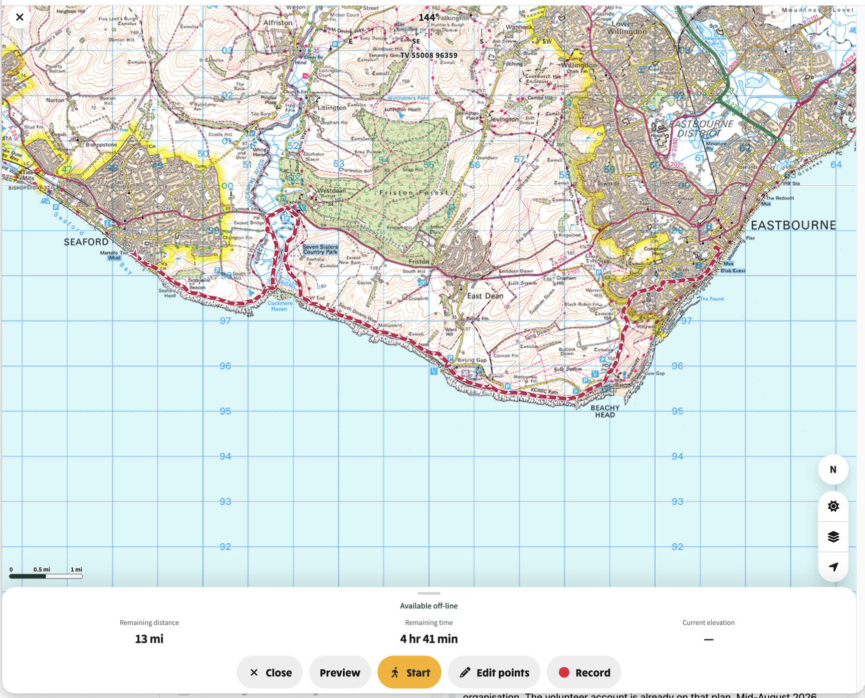
*Once the map is saved: Available off-line, compass heading and grid ref, then the same Start, Preview, Edit points and Record*
## The Walks app
You can also open the Walks app at `[/app](https://ngx-ramblers.org.uk/app)` and pick a walk. Add it to your Home Screen so it opens full screen, with no website header.
💡 The bit below is not working as of 24th August. It will be refined in a later release
> Paste a Ramblers library link and tap Follow this Ramblers route. If Ramblers have published the line, you follow it. If they have not, the screen still takes you to the start.
Walks and routes already on the phone say they are available off-line. Ones that still need a network say so. A walk with no line yet offers Record route instead of Follow.
## Edit the route
If you are a walk admin or the walk leader, tap Edit route on the walk page, or Edit points on the follow map.
Every route vertex appears as a white dot. The pencil is on by default: drag a dot and the line follows your finger as you move, not only when you let go. Tap the line between two dots, or just beside it, to insert a new point; the cursor becomes a point so you can see you are adding, not panning. Switch to the eraser and tap a white dot to remove it.
Undo takes off the last point. Reverse swaps the start and finish so the direction arrows run the other way. Cancel puts the previous line back. Save route writes the new line onto the walk, so the walk page, the follow map and anyone else looking at that walk all see the same line.
If the route has a lot of points, typically after a GPS recording of more than about 150, you are asked first whether to Reduce data density or Keep all points. Reducing is recommended and the prompt shows roughly how many points would remain. You can still change this later with the Keep more points slider before you save.
Draw route is the same editor with no line yet: tap the map to place the first points, then drag, insert and erase as above.
Record draws the line from GPS as you walk. Discard throws that recording away. Save on a busy recording asks the same reduce-or-keep question.

If the route has a lot of points, Edit points asks whether to Reduce data density or Keep all points
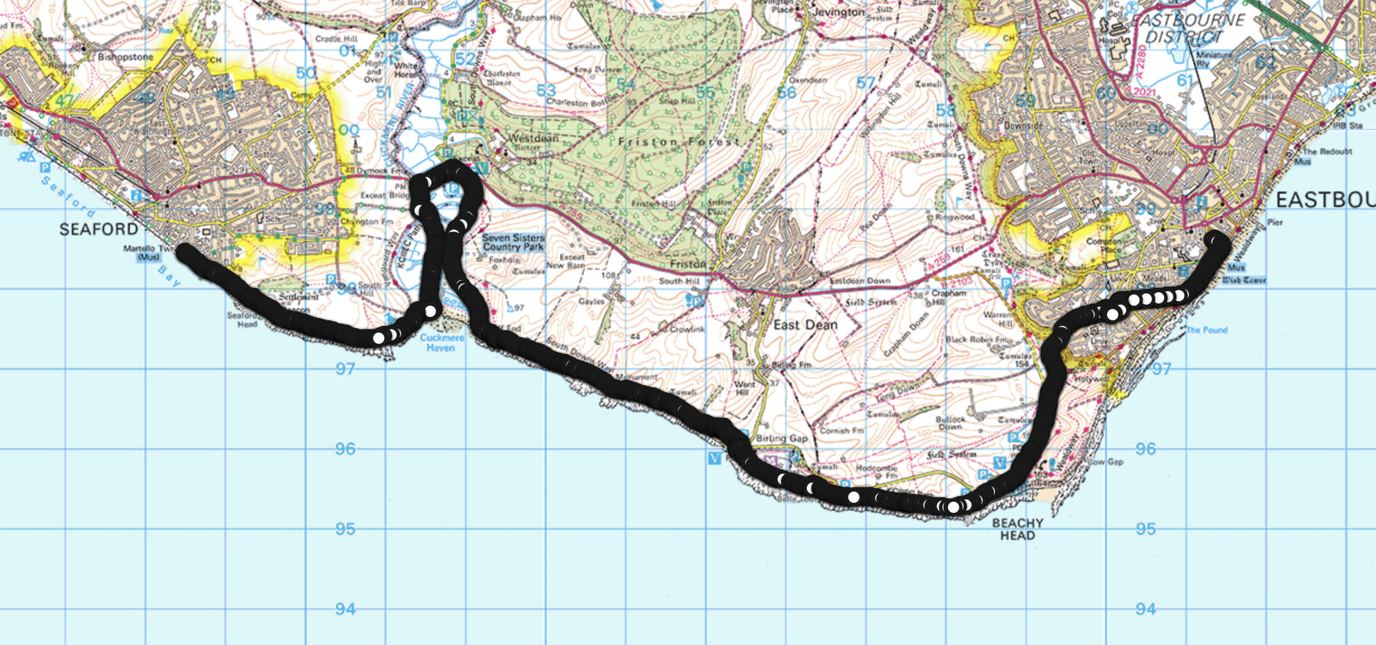
Keep all points: every vertex stays on the route
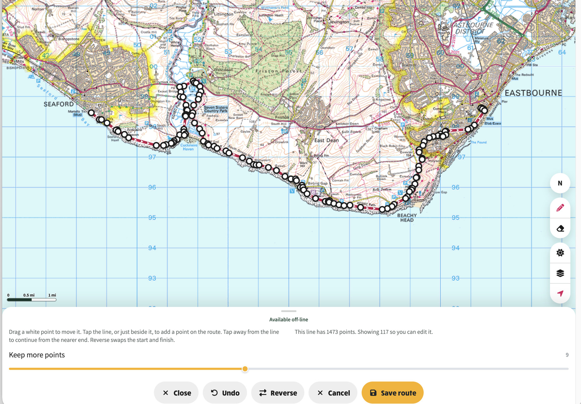
*After Reduce data density: 117 points shown, Keep more points, Close, Undo, Reverse, Cancel and Save route*
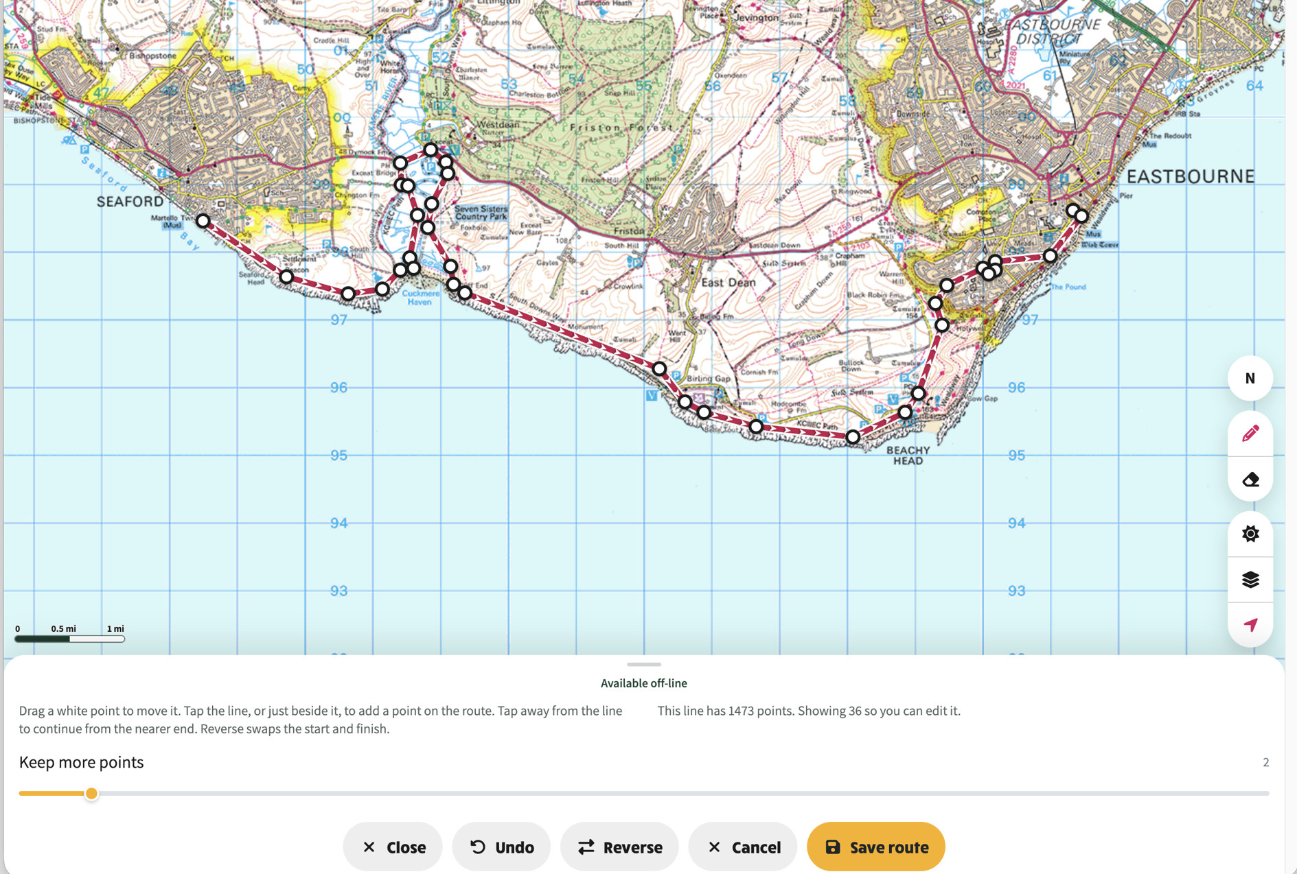
Keep more points turned down: fewer vertices on the route, still the same editor
The white arrows on the route show the direction of the walk. Reverse swaps the start and finish so those arrows run the other way. Use that when the route was drawn or recorded in the opposite direction to the walk.
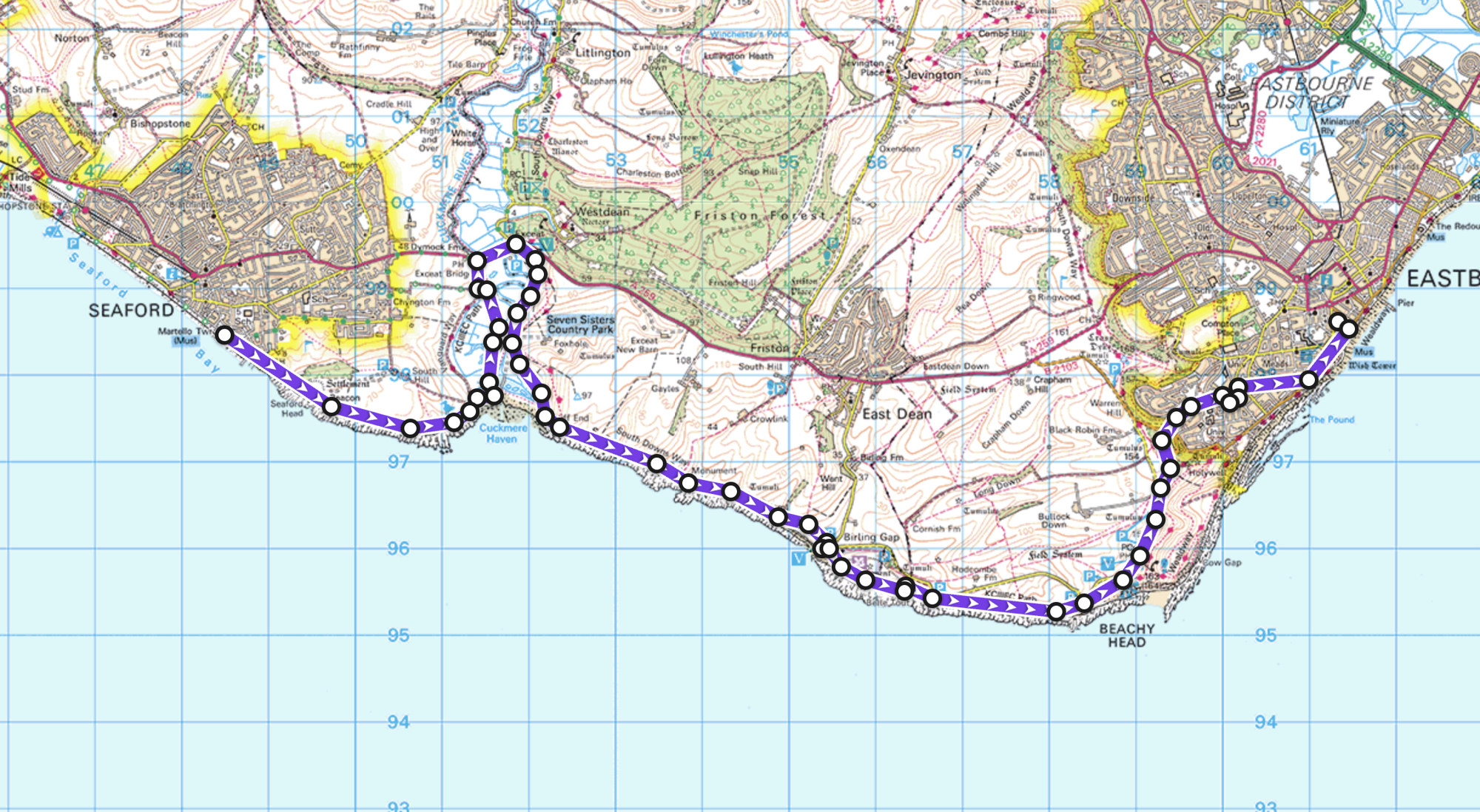
Before Reverse: the arrows on the route run from Seaford toward Eastbourne
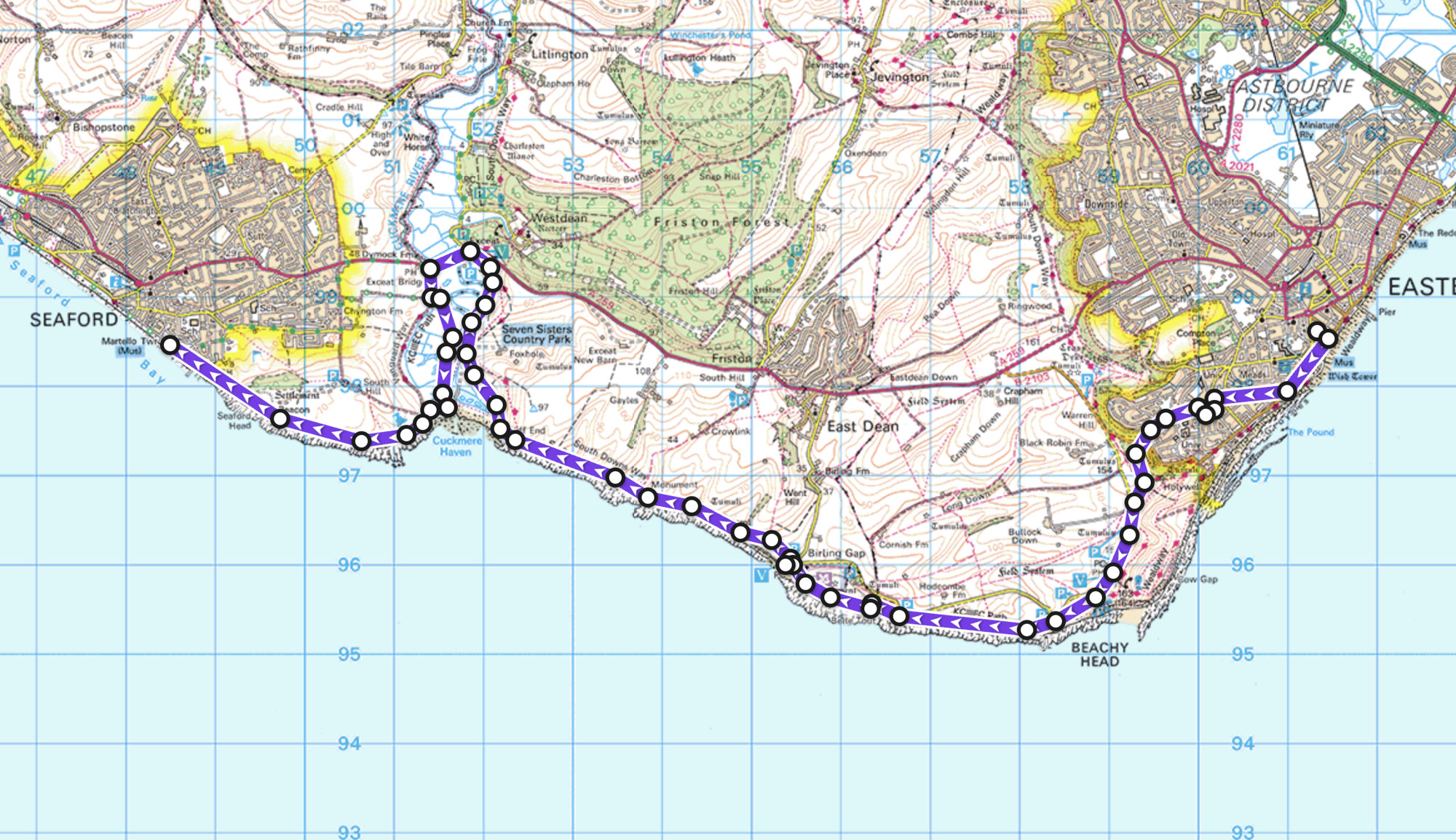
*After Reverse: the arrows now run from Eastbourne toward Seaford. Start and finish have swapped*
## Maps and style
The stacked-layers tool on the right opens **Maps**.
Tap a tile to preview it. The panel stays open so you can compare Explorer, Outdoor, Light, Road and OSM. Undo in the corner puts back the map you had when you opened the panel; Close keeps the one you are looking at. Switching to OSM keeps the same ground scale as the OS map you were on.
**Route line** changes colour, thickness and transparency. Extra colours are there that do not look like OS road colours, so the walk line stays easy to see on Explorer and Outdoor. Nothing is written until you tap the save control (when you are not in the editor) or **Save route** (when you are).
Hover or long-press any of the follow tools for a short tooltip.
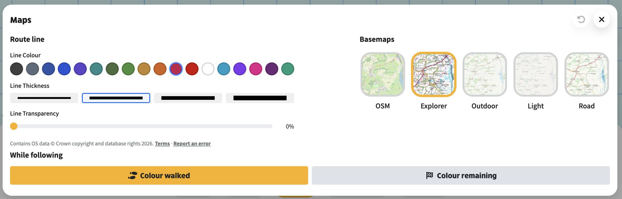
*Maps: route colour, thickness and transparency on the left; OSM, Explorer, Outdoor, Light and Road on the right; Colour walked or Colour remaining while following*
## At a glance
- On a walk page, **Follow this route** opens the full-screen follow map
- Related links use their own marks: Ramblers, OS Maps, GPX, calendar and what3words
- Start and finish postcodes and grid refs are tappable, and the copy icon copies them
- If you can edit the walk: **Edit route** when a line exists, or **Record route** when it does not
- From the walk editor, **Record or edit on the map** sits next to Upload New GPX
- Install the Walks app from [`/app`](https://ngx-ramblers.org.uk/app "{{siteUrl}}"); the site header and footer stay hidden while you are in it
- Paste a Ramblers route link to follow a library route
- After you have opened a route once, the map is kept for when the signal drops
- **Start** follows the line with remaining distance, time and elevation; **Pause**, **Resume** and **Stop** work as you would expect
- **Preview** plays the route through; a speed slider appears only while preview is running
- Off the line, you are told to head back to it
- **Edit points** opens every vertex as a white dot; drag to move, tap the line to insert, eraser to remove
- **Undo** removes the last point; **Reverse** swaps start and finish
- A busy line of more than about 150 points asks whether to reduce the data density first
- **Maps** shows Explorer, Outdoor, Light, Road and OSM as real preview tiles
- Style is only saved when you tap the save control or **Save route**
- **Close** leaves Follow for the walk or list you came from
*See also: [Planning and following walk routes](https://www.ngx-ramblers.org.uk/how-to/committee/walks/route-planning-and-following) in the how-to guides, which walks through drawing a route, generating and editing its directions, importing from OS Maps and following a walk on a phone.*